DeKalb County has many zoning categories. Most of us are familiar with the difference between residential and commercial districts, but within these overall categories there are many subcategories. Each category has its own rules for what types of development are permitted to occur.
R-100 means that an area is zoned residential, and all the lots developed in that district are at least 100 feet wide. The property on Briarlake Road owned by Charles Cathey is currently zoned R-100, so that means that a developer who buys the land has permission from the county to create lots that are 100 feet wide, and that those lots can be purchased by a builder to build single-family residences.
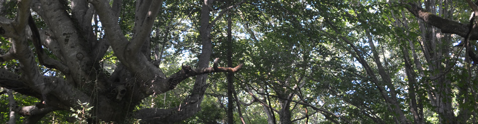
Creating lots involves both filing a plan with the County that shows where the lots are and hiring a contractor to tear up (or “disturb”) the land to make the lots. This involves uprooting trees, scraping all the topsoil off the area, and marking out lot lines usually with pieces of rebar in the four corners of a rectangular lot.
The County has many other residential categories, such as R-150, meaning the lot sizes are 150 feet wide, or R-85, where the lots are 85 feet wide – on down to R-50, where the lots are 50 feet wide for single-family residences.
There is another category, R-NCD, which means “residential, neighborhood conservation district,” that permits developers to create 60-foot wide lots where the footprint of the house built on each lot can be relatively large. The lots are smaller and the houses are clustered together in order to “conserve” the adjacent undeveloped land as greenspace. The area that is developed, however, still has most if not all of the vegetation and topsoil removed.
The developer that is interested in the Cathey property, Arrowhead Real Estate Partners, has filed a request to rezone the property as R-NCD. This would give him permission from the county to create 60-foot wide lots on which builders can build houses that are large for the lot size, creating an overall “clustered” appearance to the resulting neighborhood.
Zoning ordinances are created by counties to limit development so that people are protected from possible harm resulting from development. The state authorizes counties to make zoning ordinances, effectively delegating part of its police power to the counties. The U.S. Supreme Court first upheld zoning ordinances in a landmark case (Euclid v. Ambler) in the 1920’s, on the basis that there is a “valid government interest in maintaining the character of a neighborhood” (see Wikipedia article on the Euclid v. Ambler case).
Disturbing the land can cause harm to people in the surrounding area. The zoning review process is meant to raise awareness of the possible harm that development might cause so that the county can make its decision for the public welfare. The county owes a fiduciary duty to the state to uphold the public welfare in exchange for the state’s grant of police authority to the county to enforce zoning ordinances.
Our analysis of the options proposed by the developer suggests that the best course of action is to oppose rezoning. We believe that changing the zoning category to R-NCD opens the community to the potential for greater harm than currently exists with land zoned R-100.
Here is a breakdown of the consequences of each proposal as we understand them:
Best: Private and/or County buys all or most of land for preservation.
Mid: R-100 development with Private and/or County purchase of more than 20% minimum contiguous greenspace.
Worst: R-100 development with 20% greenspace.
R-NCD:
Best: Private and/or County buys all or most of land for preservation.
Mid: R-NCD Cluster development with possible County purchase of 30% or more contiguous greenspace. No guarantee.
Worst: R-NCD Cluster development with two or more non-contiguous greenspaces adding up to 30%.
In the best case, there is no reason to approve rezoning because the consequence would be the same – the County and/or a private concern buys all or most of the land for preservation.
In the two middle cases, there would be a purchase by the county and/or a private concern of a certain amount of contiguous greenspace, anywhere from 25% to 75% perhaps, for preservation of the forest. The middle case for R-100 would allow some development of R-100 lots, consistent with the surrounding neighborhoods. The middle case for R-NCD would allow some development of R-60 lots. Creating smaller lot sizes than the surrounding neighborhoods is inconsistent with the surrounding neighborhoods. Moreover, it is inconsistent in a way that diminishes the value of the surrounding properties.
The worst cases still have greenspaces, but notice that the R-NCD cluster development can have non-contiguous greenspaces that together add up to 30%. This breaking up of the forest land combined with the R-60 cluster homes would be the worst possible case among the proposed options. In this case, both the ecosystem services and the consistency with the surrounding neighborhoods would be lost.
The proposed rezoning to R-NCD, therefore, presents a worst case scenario that produces a double loss to the surrounding neighborhoods and to the county as a whole. Changing the zoning increases the risk of undesirable consequences for the surrounding community. For this reason, we recommend that the County Commission reject this proposal.
Pingback: Five Principles of Successful Citizen Action for the Environment | Lessons of 21 Acres